If you spend enough time on the water, you’ll hear experienced boaters say the weather can change in minutes. One moment the sea is calm. The next, the wind picks up, waves build, and the trip home becomes much less enjoyable. That is why checking the marine weather forecast should be part of every boating trip. It takes only a few minutes, but it can help you avoid uncomfortable conditions and make safer decisions for yourself, your passengers and your boat.
Many people look at the weather app on their phone and assume that is enough. While it tells you if rain is expected or how warm the day will be, it does not give you the information you need for boating. A marine weather forecast is very different. It includes details about wind, swell, waves, tides and marine warnings. These are the conditions that affect how your boat will handle once you leave the boat ramp. If you are new to boating, all the numbers and boating terms can seem confusing at first. The good news is that they are easier to understand than they look. Once you know what each part of the forecast means, you can quickly decide if the conditions suit your plans.
In this guide, we’ll explain how to read a marine weather forecast in plain English. By the end, you’ll know what to look for before every trip and how to use that information to make better decisions on the water.
Why a Marine Weather Forecast Is Different
A regular weather forecast is designed for people on land. It focuses on air temperature, rainfall, humidity and general wind conditions. A marine weather forecast looks at what is happening on the water. Even on a sunny day, the sea can be rough enough to make boating difficult. Likewise, a cloudy day does not always mean poor boating conditions.
Marine forecasts include information that matters to boaters, such as wind strength, wind direction, swell height, wave period, tides and marine warnings. Together, these details tell you what the conditions are likely to be throughout your trip. It is also worth remembering that conditions offshore are often very different from conditions on land. You might leave home with almost no wind, only to find strong winds and rough seas once you head further from the coast.
For that reason, experienced skippers check the marine forecast before every trip, even if they know the local area well.
Where to Check Marine Weather in Australia
Australia has several reliable sources of marine weather information. Each offers slightly different features, so many boaters compare more than one before heading out. The Bureau of Meteorology, often called the BoM, is the official source for Australian marine forecasts. It provides coastal waters forecasts, wind warnings, tide information and severe weather alerts. Most experienced skippers use the BoM as their starting point. Many recreational boaters also use Seabreeze. It provides detailed wind forecasts and is especially popular with anglers, sailors and surfers. It is easy to compare wind conditions across different parts of the coastline.
Windy is another excellent tool. Its interactive maps show approaching weather systems, wind direction, swell and rain. It is particularly useful if you want to see how conditions are expected to change throughout the day. WillyWeather combines weather, tides, swell, wind and sunrise information in one place. Many people use it as a quick reference before launching. No forecast is perfect. Weather can change quickly, especially around the coast. Comparing two or three trusted sources gives you a better understanding of what conditions are likely to do during the day.
Understanding Common Marine Weather Terms
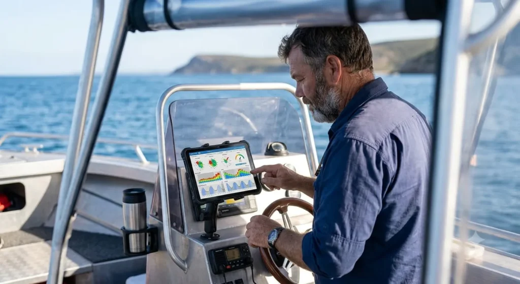
Marine forecasts use words that you may not see in a normal weather report. Learning a few simple terms makes the forecast much easier to understand.
Knots measure wind speed. One knot is about 1.85 kilometres per hour. Marine forecasts use knots because they are the standard unit across the boating industry.
Swell refers to waves that have travelled from distant weather systems. These waves can arrive even when the local weather is calm.
Wind waves are different. They are created by local winds and usually become rougher as the wind increases.
Wave period is the time between each wave passing the same point. It is measured in seconds.
Tidal movement refers to the rise and fall of sea level throughout the day.
You may also see hPa, which stands for hectopascals. This measures air pressure. While experienced boaters sometimes use air pressure to help predict weather changes, most recreational boaters can safely focus on wind, swell and marine warnings. Do not worry about memorising every term. As you check forecasts more often, they will soon become familiar.
How to Read Wind Speed
Wind is usually the first thing boaters look at when reading a marine forecast. Light winds often create calmer conditions. Stronger winds usually mean rougher water and a less comfortable ride. As a general guide, winds below 10 knots are considered pleasant for most recreational boating. Lakes, estuaries and sheltered bays are usually quite comfortable in these conditions.
When the forecast reaches around 10 to 15 knots, you can expect some chop on open water. Most quality aluminium boats, including Sea Raider models, can still handle these conditions comfortably when driven sensibly. However, passengers may notice a bumpier ride. Once winds increase beyond 20 knots, conditions become more demanding. Waves become steeper, spray increases and travelling offshore requires much more care.
Keep in mind that forecasts usually show sustained wind speeds. They also include gusts, which are short bursts of stronger wind. A forecast of 15 knots with gusts to 25 knots can feel very different from a steady 15-knot breeze.
Why Wind Direction Matters
Wind direction is just as important as wind speed. Marine forecasts describe the direction the wind is coming from. For example, a southerly wind blows from the south. A north-easterly wind blows from the north-east. The direction affects the way waves build along the coastline.
An offshore wind blows from the land towards the sea. This often creates flatter water close to shore because the wind pushes the surface away from the coastline. While that sounds ideal, offshore winds can make returning to shore more difficult if your boat loses power. They can also carry smaller boats further offshore. An onshore wind pushes waves towards the coast. This often creates rougher conditions near beaches and headlands. Local geography also plays a part. A bay protected from southerly winds may become rough when the wind swings around to the east. As you gain experience in your local area, you will learn which wind directions produce the best boating conditions.
Wave Height and Swell Height
One of the biggest mistakes new boaters make is assuming wave height and swell height mean the same thing. They are different. Wind waves are created by local winds. If the wind increases during the day, these waves often become steeper and closer together. Swell comes from weather systems that may be hundreds or even thousands of kilometres away. It travels long distances before reaching the coast. Imagine a calm day with very little wind but a large swell rolling in from a distant storm. The weather may look perfect, but the ocean can still have powerful waves. The opposite can also happen. You may have only a small swell, but strong local winds can quickly create short, steep waves that make boating uncomfortable.
This is why experienced boaters always read the wind and swell together instead of looking at just one number.
Why Swell Period Is So Important
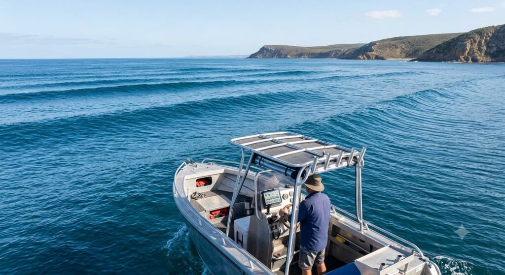
Many people focus only on swell height. Experienced skippers also look closely at the swell period. Swell period measures the time between one wave and the next. It is shown in seconds. A longer swell period usually means waves are further apart. Even if the swell is reasonably large, the ride often feels smoother because there is more space between the waves. A short swell period creates waves that arrive one after another. They become steeper and can make even moderate swell feel rough. For example, a two-metre swell with a 14-second period is often far more comfortable than a two-metre swell with a six-second period. Once you understand swell period, you will start seeing why some boating days feel much rougher than the forecast first suggests.
Don’t Forget the Tides
Tides affect much more than water depth. They influence launching, retrieving and navigating through shallow areas. They also affect sandbars, river entrances and coastal currents. Many fishing spots produce better results around a changing tide because baitfish become more active as the water moves. Strong outgoing tides can also create rough water when they meet incoming swell. This is common around river mouths and coastal bars. Always check tide times before your trip, especially if you plan to cross a bar or travel through shallow water.
Visibility Matters Too
Rain is not always the biggest concern on the water. Poor visibility can be much more dangerous. Fog, sea mist and heavy rain make it harder to spot navigation markers, other boats and floating hazards. If visibility is expected to deteriorate later in the day, think about how that might affect your trip home.
Even if your boat has GPS and modern electronics, good visibility is always the safest option.
Watch for the Afternoon Sea Breeze
One thing many Australian boaters learn quickly is that the weather often changes during the afternoon. Along much of Australia’s coastline, light morning winds strengthen as the land heats up. This creates what is known as a sea breeze. The morning may begin with calm conditions that are ideal for boating. By lunchtime, the wind can increase enough to create a choppy sea. This is why many experienced anglers launch before sunrise. They make the most of the calmer morning conditions and return before the afternoon wind builds. When reading the forecast, look at how conditions are expected to change throughout the day rather than focusing only on the weather when you launch.
Sometimes the trip home is the part that deserves the most attention.
Understanding Marine Weather Warnings
Marine weather warnings deserve your full attention. They are issued when conditions are expected to become hazardous for people on the water. The Bureau of Meteorology issues different types of warnings depending on the forecast conditions. The most common warning recreational boaters will see is a Strong Wind Warning. This means winds are expected to reach 26 to 33 knots. For many trailer boats, those conditions can make offshore boating uncomfortable and, in some cases, unsafe.
A Gale Warning is more serious. Winds are expected to reach 34 to 47 knots. Large waves, heavy spray and poor visibility often come with these conditions. Recreational boating should be avoided.
A Storm Force Warning and Hurricane Force Warning are rare but extremely dangerous. If either of these warnings is issued, the safest place for your boat is on the trailer or securely moored.
It is also important to read the full forecast instead of looking only at the warning itself. A warning may only apply to certain parts of the coastline or for a specific period during the day. Knowing when conditions are expected to change helps you plan your trip more safely.
How to Read a Real Marine Forecast
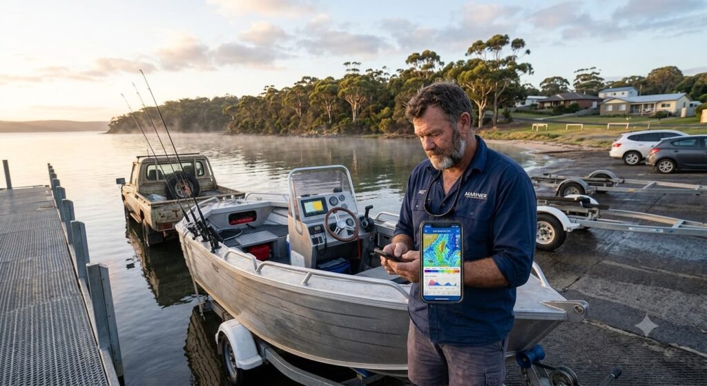
The easiest way to understand a marine forecast is to break it into smaller sections. Imagine the forecast below is for your local boating area.
Forecast
Winds: South-easterly 10 to 15 knots, increasing to 20 knots during the afternoon.
Seas: Around 1 metre.
Swell: South-easterly 1.5 metres with a 12 second period.
Weather: Sunny morning. Chance of showers later.
Warning: Nil.
At first glance, it might seem like a lot of information. In reality, it tells you everything you need to know.
The wind will be fairly light during the morning. That suggests a comfortable run offshore for most recreational boats. However, the wind is expected to strengthen during the afternoon. If you stay out too long, the trip back could be much rougher. The one metre sea state tells you locally generated waves should remain manageable. The 1.5 metre swell is not particularly concerning because it has a 12 second period. The waves will be well spaced rather than steep and close together. There are no marine warnings, which is another positive sign.
Looking at the forecast as a whole, an experienced skipper might decide to launch early, enjoy a few hours on the water and head back before the stronger afternoon winds arrive. That is exactly how marine forecasts should be used. Instead of focusing on one number, look at how all the conditions work together.
Deciding Whether to Launch
Even with a good forecast, every skipper still has to make the final decision. There is no single wind speed or swell height that is considered safe for every boat. It depends on your boat, your experience, your passengers and where you plan to travel.
A calm bay is very different from an exposed stretch of coastline. A two-hour cruise close to shore is very different from travelling 30 kilometres offshore.
Ask yourself a few simple questions before leaving home.
Are the conditions within your comfort level?
Will they still be suitable when it is time to come home?
Has the forecast changed since you checked it yesterday?
Is everyone on board comfortable with the conditions?
If you hesitate when answering any of those questions, it is worth thinking about changing your plans.
The fish will still be there next weekend.
Experience Makes a Difference
The more time you spend on the water, the easier marine forecasts become to understand. You will begin to notice patterns. You might discover that a northerly wind creates calm conditions at your favourite fishing spot, while a south-easterly quickly makes it uncomfortable. You may find that a forecast showing a one metre swell feels completely different depending on the swell period. Keeping a simple boating diary can help. Write down the forecast before each trip, then compare it with what you actually experienced on the water. After a few months, you will start recognising which conditions suit your boat and your local area.
There is no better teacher than experience.
Common Mistakes New Boaters Make
One of the biggest mistakes is checking only the weather forecast instead of the marine forecast. A sunny day does not always mean calm seas. Another common mistake is looking only at wind speed. Wind direction, swell height and swell period all play an important role. Many people also check the forecast the night before and assume nothing will change. Marine forecasts are updated regularly. Always check again before leaving home and once more before launching. Some boaters focus only on the trip out. They forget to consider what conditions will be like when they return several hours later. Afternoon sea breezes catch many people by surprise, particularly during the warmer months. Finally, avoid relying on one weather app. Comparing forecasts from the Bureau of Meteorology with services such as Seabreeze or Windy gives you a clearer picture of what to expect.
Make Checking the Forecast Part of Your Routine
Reading the marine forecast should become as routine as checking your fuel level or packing your life jackets. It only takes a few minutes. Look at the wind strength, wind direction, swell height, swell period, tide times and any marine warnings. Think about how those conditions will affect your trip from start to finish.
If the forecast changes or conditions look worse than expected, do not be afraid to postpone your trip. Experienced skippers know that good judgement is just as important as good boat handling.
Final Thoughts
Learning how to read marine weather forecasts is one of the most valuable skills any boat owner can develop. You do not need to become a weather expert. You simply need to understand the key pieces of information that affect your time on the water. With every trip, you will become more confident reading forecasts and recognising how different conditions affect your boat. The goal is not just to enjoy smoother days on the water. It is to make better decisions before you even leave the ramp. A few minutes spent checking the forecast can help you avoid rough conditions, protect your passengers and make every boating trip more enjoyable.
Frequently Asked Questions
A regular weather forecast focuses on conditions on land, such as temperature and rainfall. A marine weather forecast is designed for people on the water. It includes information about wind, swell, waves, tides and marine warnings.
It depends on your boat, your experience and where you plan to boat. Many recreational boaters find winds below 10 knots comfortable. Conditions often become choppier once winds reach 15 to 20 knots. Always consider the forecast as a whole rather than looking at wind speed alone.
It means the average height of the ocean swell is around one metre. Whether that feels comfortable depends on the swell period, wind conditions and your boat.
Yes. Many experienced boaters compare forecasts from the Bureau of Meteorology with services such as Seabreeze or Windy. Looking at more than one source helps you spot any differences and gives you greater confidence before heading out.
Most forecasts are updated several times each day. It is a good idea to check the latest forecast before leaving home and again before launching your boat.
Yes. Forecasts are based on the best available information, but weather can change quickly. Keep an eye on the conditions around you and be prepared to head back early if they begin to deteriorate.
In many parts of Australia, winds increase during the afternoon as sea breezes develop. That can create choppier conditions later in the day, even if the morning was calm.
If you have not launched yet, it is usually best to postpone your trip. If you are already on the water, head back while conditions are still manageable and continue to monitor the latest forecast.
General weather apps are useful, but they do not provide all the information boaters need. Always check a dedicated marine weather forecast before heading onto the water.